 Feature Comparison
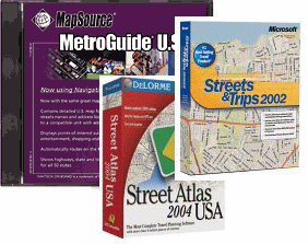
I put together this table out of frustration that none of the desktop mapping software out there has a "complete" set of features for working with (Garmin) GPS units. For example, MapSource is very tightly integrated with Garmin units, but lacks some basic features like finding street addresses and importing waypoints from other programs. Street Atlas can look up multiple addresses in bulk, but has trouble downloading that data to a Garmin unit. Streets & Trips can find addresses in both the U.S. and Canada, but can't download to GPS units at all, and can't export the data in text format. Thus, you really need all the programs to get a good feature set.
| Garmin MapSource | DeLorme Street Atlas | Microsoft Streets & Trips | EasyGPS Basic | |
| Import Waypoints | No | Yes (text) | Yes (text) | No |
| Export Waypoints | Yes (text) | Yes (text) | No | No |
| Upload Waypoints from GPS | Yes | Claimed | No | Yes |
Download Waypoints to GPS |
Yes | Claimed | No | Yes |
| Show Waypoints on Map | Yes | Yes | Yes | No |
| Export Map | No | No | Yes (GIF) | No |
| Download Map to GPS | Yes | No | No | No |
| Find Street Address | Yes (GPS unit) / No (desktop) | Yes (multiple) | Yes (multiple) | No |
| Includes Canada | Available | No | Yes | N/A |
| Cost | $100 each mapset | $50 | $50 | Free |
Conventions
- "Import/Export" reflects ability to exchange data with another desktop application
- "Upload/Download" reflects ability to exchange data with GPS units
- "No" means a capability only exists in a vendor's proprietary format, if at all; "yes" indicates a universal format, like text or .gif
- "Claimed" indicates the vendor claims a capability that I have been unable to accomplish with a Garmin GPS unit without a system crash
- "Multiple" means that the program can process a file of addresses in bulk
- "Available" means feature is not included in basic U.S. datasets, but available in additional dataset at extra cost
Notes
- Sometimes newer doesn't mean better. I've seen user reviews on Amazon, for example, saying that v5 of MapSource with NavTech is a memory hog and isn't as good as v4. And a friend has told me that MS Streets & Trips 2003 is a step backward from earlier editions, although the 2004 version is better. Consider buying older editions from eBay and Amazon, especially if you're just getting started and are on a tight budget.
- It's possible to "export" any map to a .pdf file, but it requires that you have Adobe Acrobat file creation capabilities (not part of the free Acrobat reader). You can also cut and paste a displayed map to a graphics program like PaintShopPro, but again it requires purchase of the graphics program.
- Non-proprietary GPS file formats are available but are not common to more than one program
- Some programs have additional capabilities to exchange data with PDAs (Palm, WinCE), but those capabilities are not shown here
- Even when export/import is in text format, editing is required for that text to be used by another application
- I wouldn't recommend Rand McNally's StreetFinder and TripMaker as a mapping package. I found it inferior to the three "major" packages shown in the table. Its main attraction is its cheap price.